Beyond the Surface: Using Community Insights, Spatial Data, and Underwater Verification to Strengthen Environmental Audits

Lead Author: Aminath Nausha, Co Authors: Hussain Niyazy, Ibrahim Aiman, Mohamed Ibrahim Jaleel, Aminath Muaza. Auditor General’s Office of the Maldives
Introduction
Environmental audits, especially in marine protected areas, face challenges in obtaining reliable evidence as environmental conditions often evolve gradually and are not completely reflected in routine monitoring records. Such challenges may necessitate an approach beyond conventional audit methods.
During the environmental audit of governance and coordination mechanisms in the Protected areas of the Baa Atoll Biosphere Reserve, the audit team encountered issues that could not be fully resolved through document review alone. Addressing these questions required innovative approaches that ultimately strengthened the audit findings. This enabled our team to independently validate stakeholder observations, strengthen the audit evidence base, and identify issues that may otherwise have remained undetected.
This article shares our experience of integrating these techniques into an environmental audit and how we embed other verification methods with limited resources, in complex and dynamic settings.
Audit Objective and Scope
The audit aimed to assess the effectiveness of governance and coordination mechanisms for managing protected areas within the Baa atoll biosphere reserve for the duration of 2015–2024, examining both terrestrial and marine protected zones.
To build an understanding of the system, the audit team initially reviewed relevant documentation, including policies, monitoring reports, and regulatory frameworks, and conducted interviews with key institutional stakeholders.
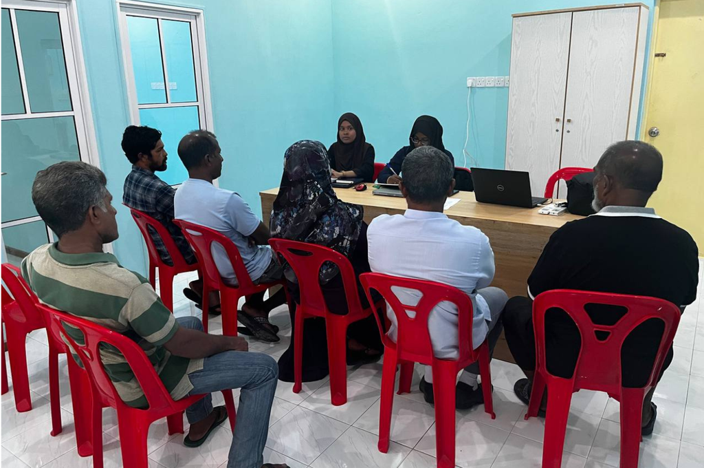
In an initiative to enhance community involvement in the audit process, the audit team conducted focus group discussions with key stakeholders across the atoll, including divers, farmers, fishermen, guesthouse operators, resort representatives, and local councils. In parallel, perception surveys were administered to capture broader public views on the audit subject. These discussions provided valuable insights and highlighted noticeable changes within the protected areas of the Atoll. One of the significant changes notified was the disappearance of B. Bathalaa island which was a part of a Protected Area designated on 05 June 2011. This was a pivotal moment in the audit, where stakeholder knowledge became a trigger for further investigation.
Building a Complete Picture
While stakeholder interviews and documentary reviews are essential, they also revealed gaps. Across institutions, information was fragmented, and some records were inconsistent or incomplete. Several stakeholders reported environmental changes over time, however, limited evidence existed to document their extent or the response of the monitoring agencies.
With these limitations, the audit team sought to expand the evidence base beyond document verifications in order to see the bigger picture. This involved identifying alternative methods that could provide independent, objective, and time-referenced information to complement stakeholder observations, leading to the incorporation of geospatial analysis from satellite imagery, followed by field verification.
An Aerial Perspective
Satellite imagery formed a key basis for preliminary analysis. Time series analysis was conducted for Protected areas using ESRI Wayback World Imagery and Google earth from the 1990s onwards to assess changes in coastal features and land areas during this period. One notable observation aligned with stakeholder information: a small island known as B. Bathalaa was no longer existent in more recent images.
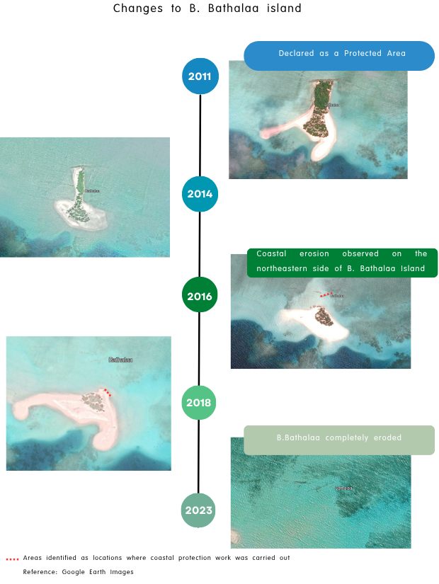
To assess whether this change could be attributed to natural island morpho-dynamics, the team extended the time series analysis to islands in the surrounding area. No comparable changes were observed in neighboring islands, suggesting that natural processes alone were unlikely to explain the disappearance. This pointed to the potential influence of anthropogenic activities. Further analysis of infrastructure development and physical modifications revealed evidence of coastal protection works carried out around the island. This analysis aided in further investigation, helping identify the location requiring physical inspections.
Validating Findings Through Underwater Observation
Spatial analysis indicated the possible presence of coastal protection works along the island’s shoreline. To verify this observation, meetings were held with the authority responsible for monitoring the area. The Office confirmed the finding and provided evidence of an inspection conducted in response to a public report. During this inspection, the coastal protection works were observed in progress.
However, as the island was under lease, the office did not pursue further action, instead issuing an informal notification to the relevant monitoring authority. While these consultations strengthened and corroborated the spatial analysis, the absence of photographic evidence necessitated further investigation.
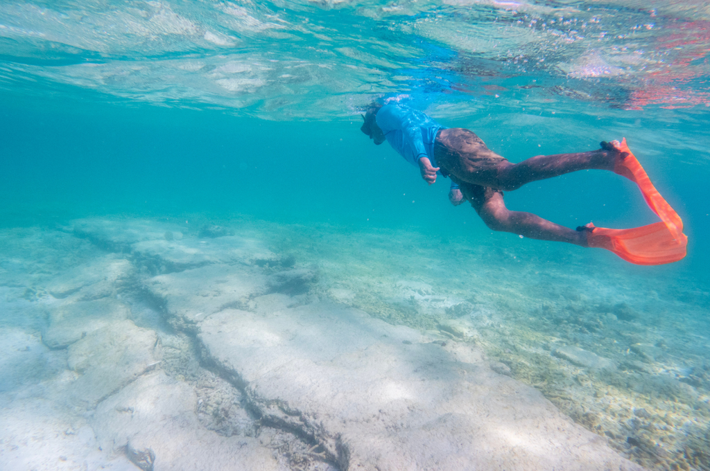
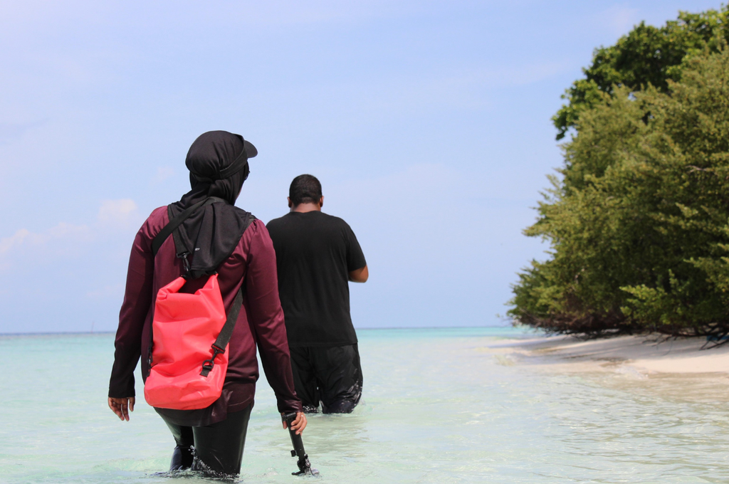
The team conducted underwater visual inspections in selected areas identified through geospatial analysis. Locating the precise areas of coastal infrastructure proved challenging due to the absence of unmanned aerial vehicle (drone) support and strong lagoon currents, which required the team to snorkel for extended periods in the open lagoon.
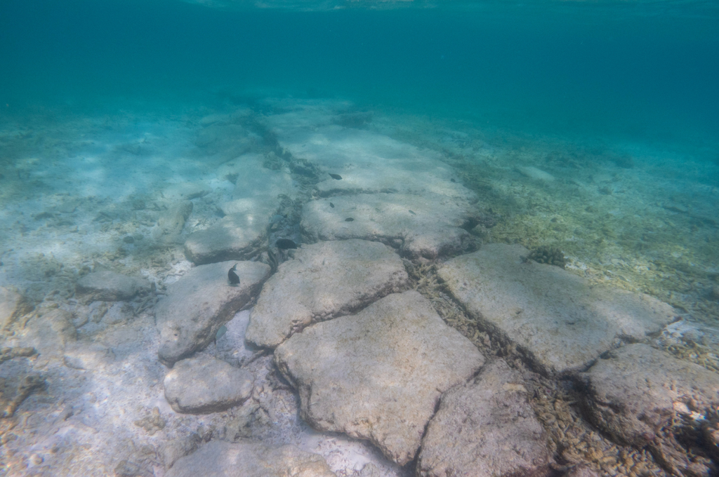
Despite these challenges, evidence of submerged coastal protection measures was eventually identified. Remnants of structural works were observed beneath the water surface. Subsequent review indicated that no feasibility studies or Environmental Impact Assessments had been conducted, and no permits had been issued by the relevant authorities for the coastal modifications undertaken on the island.
Photographs, observations, and location data collected during the inspections were carefully documented. Direct observation of the area through snorkeling than relying solely on secondary information added value to the finding. The evidence gathered was cross-checked against other audit evidence. The combination of satellite imagery, documentary evidence, stakeholder interviews, and underwater observations provided a much clearer picture of what had occurred within the protected area.
Most importantly, it allowed the audit team to move beyond assumptions and establish findings supported by multiple independent sources of evidence.
Root Causes
Lack of Policy Coherence and Governance
Responsibilities for island administration, conservation, tourism development are dispersed among multiple government entities. The audit found that mandates, policy coherence and coordination mechanisms were not sufficiently effective to ensure that decisions were consistently aligned with protected area requirements. This was one of the key reasons which led to leasing the island and developmental activities being conducted on the island after it was declared as a Protected Area.
Non-Compliance with Relevant Regulations
Environmental assessments, concept approvals, and adequate studies were not obtained prior to undertaking coastal protection and island modification works. The absence of these regulatory safeguards limited the consideration of potential environmental impacts which would otherwise have been flagged. Subsequent assessments by the Environmental Regulatory Authority identified the unauthorized coastal protection works as a likely contributing factor to the island’s erosion.
Weaknesses in Documentation and Regulatory Oversight
Monitoring, documentation, and enforcement processes were not sufficiently robust to support timely regulatory action. As the entity responsible for managing the Protected Area of B Atoll, though inspections were carried out to address the public complaint received regarding works carried out in the island, formal report with proper evidence was not prepared. Timely actions for the complaint were not taken by the regulatory agency and with limited follow-up it reduced the effectiveness of oversight mechanisms and weakened accountability for activities undertaken in Bathala island.
Conclusion
The audit which began as an assessment of governance and coordination within a protected marine area, involved exploring new ways of gathering evidence and understanding environmental change.
By combining satellite imagery with underwater verification, the audit team identified undocumented changes, key observations were validated, and the overall quality of audit findings were strengthened. More broadly, the experience demonstrated how innovation can emerge from practical necessity and how adaptable audit approaches can support SAIs in maintaining its effectiveness.